A Greener FiDi — Make Way for Lower Manhattan: Shared Streets Project
By: Catherine McVay Hughes
July 02, 2019
In March 2019, the Financial District Neighborhood Association (FDNA) released Make Way for Lower Manhattani (MW4LM), a vision to make the Financial District greener by making its streets and sidewalks cleaner and safer for the people who live and work there. This first-of-its-kind study was then incorporated into NYC's Earth Day 2019 announcement "ONENYC: Mayor DeBlasio Announces Transportation Measures to Increase New Yorkers' Mobility: The City has identified locations to implement its Bus Action Plan to increase bus speeds 25% by 2020, help more businesses receive off-hour deliveries, and explore new pedestrian zones in Lower Manhattan."
How did this come about? Ignited by a Bloomberg Administration NYC Department of Transportation (DOT) study of Lower Manhattan congestion called A Street Management Framework for Lower Manhattan: The Downtown of the 21st Century, community residents began a process of advocacy for clean and safe streets in their neighborhood. What have we learned in this 10+ year odyssey?
Here's what's proved crucial for FDNA to execute a successful urban change campaign:
- Engage the Community Board and Neighborhood Early On — Public Outreach is key.
- July 2015, the local Manhattan Community Board (CB1) released the Manhattan Community District 1 Needs Assessment Pedestrian Survey which was conducted in collaboration with Pace University and The City College of New York. It showed "overcrowded sidewalks" and "overcrowded streets" as the top two public realm problems in the Financial District. This analysis became the basis for MW4LM to be included in CB1's Budget Priorities that are submitted to the City government and was submitted to the Department of City Planning.
- July 28, 2015, a resolution supporting Make Way for Lower Manhattan Community Board 1 Resolution passed unanimously. CB1 acknowledged Lower Manhattan faces unique mobility and connectivity problems and CB1 supported the principles outlined in the MW4LM initiative. This resolution passed CB1 in 2015, prior to the founding of FDNA which was the first known Financial District neighborhood association, created in response to the FiDi community evolving from commercial to a mixed-use 24/7 neighborhood in 2016.
- Beginning in 2016, FDNA held many listening sessions and events to gauge community sentiment and promote awareness surrounding issues of pedestrian safety and the Financial District's deteriorating streetscape conditions. This phase of community engagement included a 2016 FDNA Petition calling for Pedestrian Safety and Mobility Study for Lower Manhattan signed by over 1,000 families.
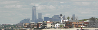
- Define the Challenges — The old, Colonial streets and sidewalks of Manhattan's Financial District have become far too crowded with modern-day obstacles, largely due to the ongoing conversion of skyscrapers to residential use and new construction of large residential buildings, coupled with the dramatic growth of downtown tourism. Piles of garbage often block sidewalks, creating health hazards and forcing pedestrians into already crowded streets. Construction scaffolding and street vendors block sidewalks everywhere. Loading zones sit adjacent to primary schools' streets, and congestion slows down emergency vehicles. Pedestrians and cyclists jostle with cars for space on streets and sidewalks — to which a recent spate of fatalities and accidents attests.
- FiDi streets are one-third as wide, with sidewalks half as wide, as east-west cross streets in the gridded portion of Manhattan above Houston Street. As far back as 1966, the City Planning Commission recognized that a new approach to managing these streets would be needed to accommodate the returning residential population — but it was never implemented.

- Define Possible and Specific Solutions which include, but are not limited to:
- Geographic reach of the shared streets pilot is a full district from Broadway to Water and Fulton to the Battery and mostly corresponds to the purple in the Slow Street District map below — and the area that was used in the NYC DOT's August 2016 Shared Streets: Lower Manhattan.

Source: Burohappold, Cities Practice - Create a Special District in this zone so that specific new rules can be applied to the area, to solve waste management and parked car issues
- Get garbage off the sidewalks through an innovative approach to pick-up schedules — interagency coordination is required with NYC Department of Sanitation (NYC DOS)
- Engage accessibility groups for best practices on access for all abilities
- Improve capacity to load and unload goods at curb — through reduced placard parking and coordination with Small Business Administration (SBA)
- Move vendors off sidewalks and into what today are parking places
- Build on Extensive, Existing City initiated Engineering and Urban Planning Studies — starting with a July 31, 2008 NYC DOT paper Street Management Framework for Lower Manhattan: The Downtown of the 21st Century. This formed the basis for September 2010 NYC DOT draft report Lower Manhattan Street Management — Shared Streets concluded that a shared street pilot zone is appropriate for implementation in Lower Manhattan. Within the pilot zone, it was determined that shared streets would enhance the pedestrian-oriented public realm and deliver potential economic and safety benefits. Don't reinvent the wheel when good studies are on hand.
- Funding — After the Lower Manhattan community, including both the local community board and FDNA, had urged its elected and government leaders for action for several years including in CB1's Budget Request Priorities, finally, in 2017, NYC Council Member Chin secured $500,000 in the NYC DOT budget to identify solutions to the area's mobility challenges.
And most importantly,
- Continued oversight and a community feedback loop are essential to make sure that the NYC Department of Transportation's (NYC DOT) MW4LM Pilot Study will be comprehensive (vs. piecemeal) to address community concerns to ensure success and to make the public domain — the sidewalks and streets — safe and work for all. FDNA has urged that NYC DOT start this pilot study immediately to alleviate problems this summer and beyond — especially during the peak tourist season and the weather is nice and before the school year resumes Fall 2019.
With the implementation of the MW4LM Pilot Study, NYC will be one step closer to meeting two 21st century goals: addressing the global climate crisis by reducing vehicular congestion, and returning the public domain to those who live, work and visit the fourth largest business district in our country. Cutting congestion means improving air quality and protecting the health of residents, workers and visitors.
Shared-street districts now successfully exist in many of Europe's historic capitals — including Dublin, Amsterdam, London, Istanbul, Paris and Barcelona. Typically, low speeds permit cars and people to access streets simultaneously, street parking is limited, and access for deliveries and cargo-loading is scheduled for specified times of day. The core of FiDi is a perfect place to start here in NYC.
Lower Manhattan has reinvented itself again and again over the last 400 years since it was New Amsterdam. For the newly born United States, Lower Manhattan was the indispensable deep-water Atlantic port; it then became the linchpin of America's transformation from an agrarian economy to a modern industrial colossus. Lower Manhattan then became the epicenter of American banking and then of global finance. A new transformation is filling the streets and sidewalks and buildings of the neighborhood right now: a 24/7 work-live community with a unique heritage, a diverse commercial district encompassing cutting-edge tech companies and world-leading marketing firms, and a burgeoning arts sector. All this is happening in FiDi as the City grapples with being on the front lines of a global climate emergency and citizen demands for a greener city. All other cities around the world are watching NY and we need to rise to the challenge and implement the funded MW4LM Pilot Study now.
Footnotes:
- “Financial District Neighborhood Association (FDNA) has undertaken the Make Way for Lower Manhattan report in partnership with a team from BuroHappold Engineering, supported by Massengale & Co., WXY architecture + urban design, Publica, Appleseed, and Sam Schwartz Engineering. Funding for the report was provided by the J.M. Kaplan Fund in cooperation with Transit Center and Carmel Partners. ” ↩
WhoIs:
Catherine McVay Hughes serves on the boards of the Battery Park City Authority, Lower Manhattan Development Corporation, The Trust for Governors Island, the South Street Seaport Museum and is a Manhattan Community Board 1 Chair emeritus. She is a member of the Advisory Board of the Earth Institute at Columbia University, as well as the President's Council of CERES. She volunteers on the WTC Scientific Technical Advisory Committee and the FiDi Neighborhood Association.
